Know which tree will breach clearance, months before it does.
GridSight® VGM turns LiDAR and satellite imagery into a species-aware growth forecast for every tree along the corridor, so crews know which tree to cut, and when, long before it becomes a
clearance violation.
The challenge.
A tree doesn’t wait for the inspection calendar.
Annual inspections treat every tree the same. Fast-growing trees can breach clearance before the next visit, putting crews at risk when storms or wildfires strike.
80% of your vegetation risk is invisible to a standard inspection program.
Ground patrols, flyovers and calendar-based pruning each catch a slice of the picture, and each miss a different one.
The gap between how fast vegetation actually grows and how often anyone looks at it is the single largest unmanaged operational risk on the corridor.
high-risk
Reactive pruning costs 3-5× more than a scheduled cut. GridSight® VGM tells you which tree needs it, months before you’d normally look.
The solution.
How it works.
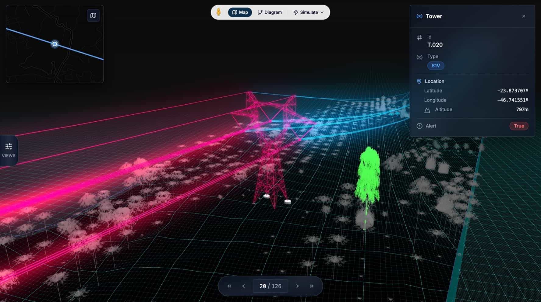
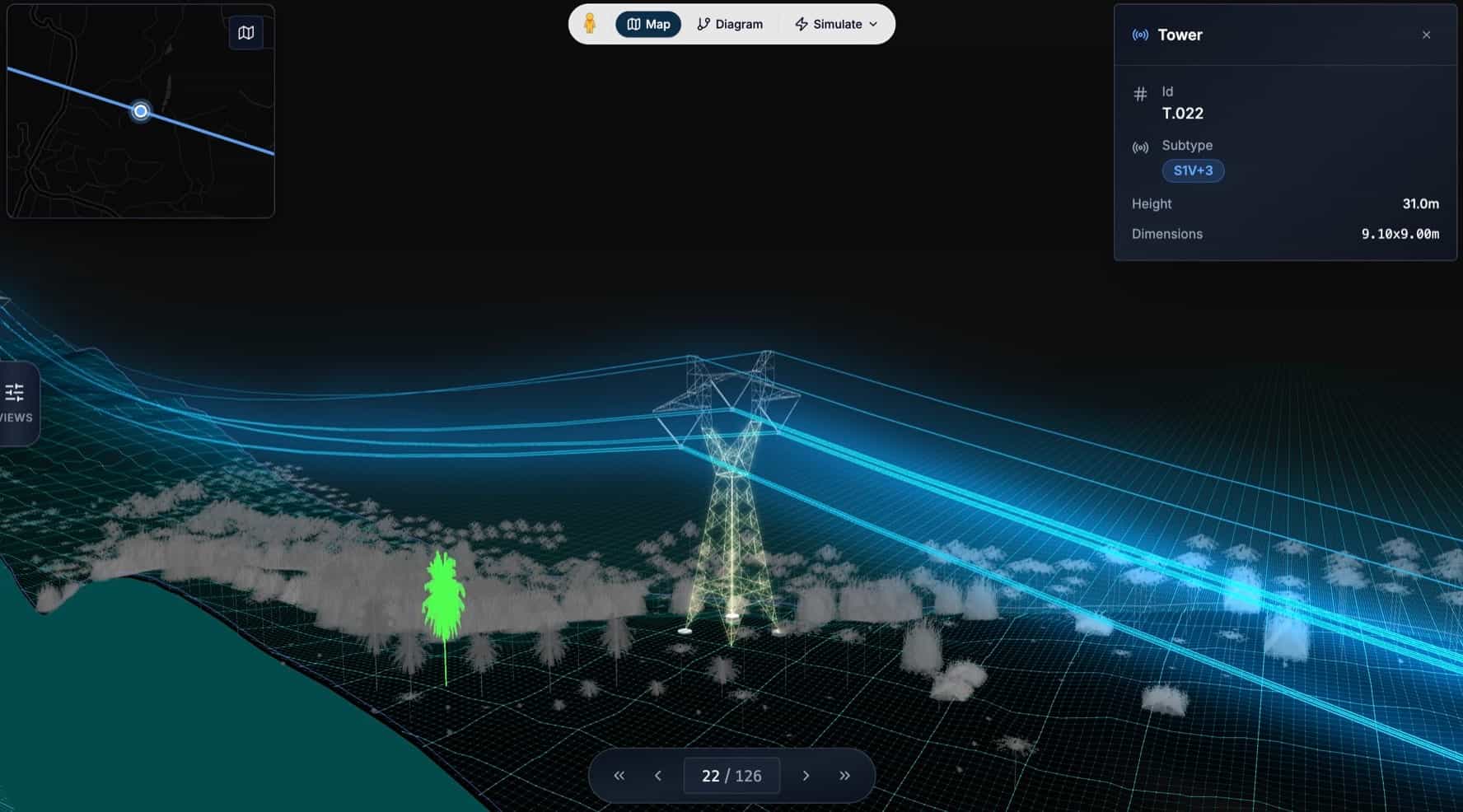
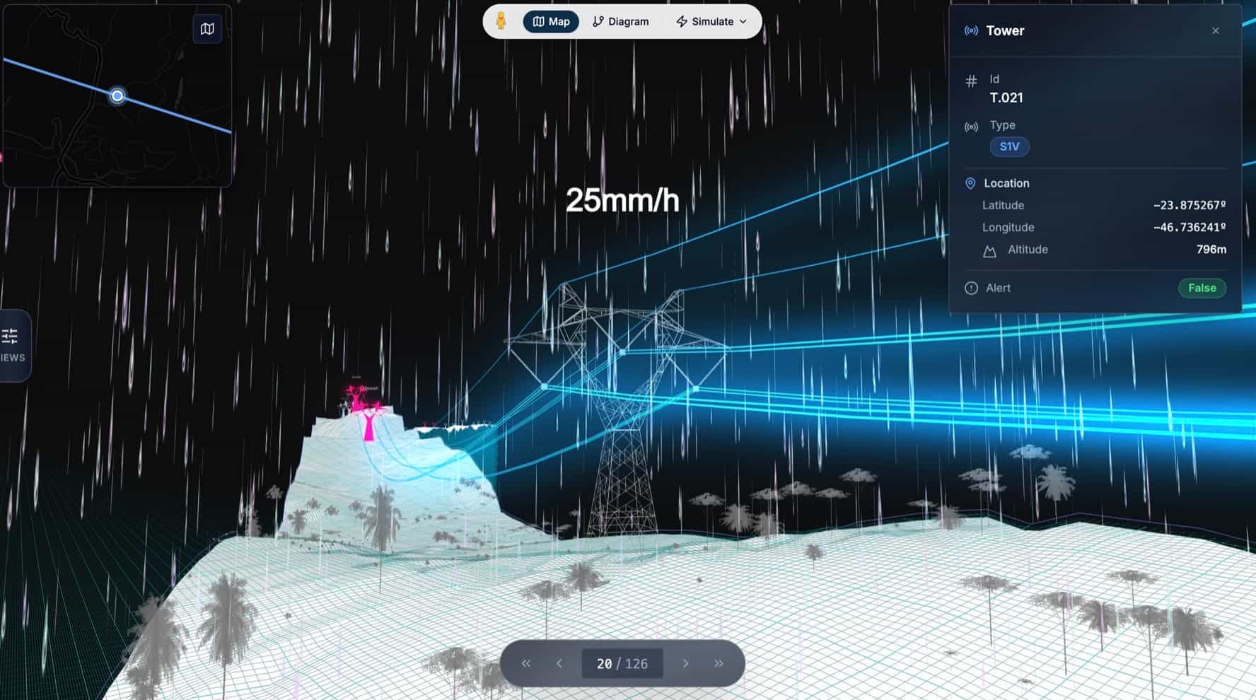
GridSight® VGM turns LiDAR and satellite imagery into a species-aware 3D model of every tree along the corridor. It classifies each one by species, projects its height forward using a growth model calibrated to that species and the local microclimate, and calculates the real distance from every tree to the conductor, not an inferred score.
When that distance is projected to close within a threshold you set, the tree is flagged, scored by risk, and scheduled for pruning, typically months before it would actually breach clearance.
Every result (risk maps, growth timelines, pruning records) exports straight into the GIS platform your crews already use (GeoJSON, WFS, Shapefile), so nothing new has to be adopted to act on it.
Gridsight® VGM.
The only vegetation platform that scores the tree, not the corridor.
Most vegetation tools give you a corridor-level risk colour. GridSight® VGM gives you the one number that matters: the real distance from this specific tree to the conductor, and how many months until that number hits zero.
on its ownReal distance to the conductor, calculated per tree from its own catenary geometry, not an inferred corridor-wide score.
wildfire riskDielectric discharge probability, modeled against wind, vegetation proximity and terrain slope, feeding directly into active wildfire-risk prevention.
Field Stories.
Real corridors. Real gains.
GridSight® VGM has been deployed across more than 400 km of medium-voltage corridor in dense Amazonian jungle terrain, one of the toughest vegetation environments a grid
operator can face.
A Peruvian DSO
400+ km of 33 kV and 66 kV overhead grid, dense Amazonian jungle terrain
On a single 437 km line within the deployment, the intelligent pruning schedule generated by GridSight® VGM produced €80k in savings within six months, reaching 100% ROI in the same period.
Read the Customer StoryWhy Enline.
Technical Depth. Sector Expertise.
Built by power systems engineers with decades of grid experience, we combine energy-domain expertise with the scientific and digital capabilities needed to reinvent grid operations.
Enline is a team of 55+ engineers, scientists, data experts, and industry specialists. We build technology that helps grid operators unlock more capacity from the infrastructure they already have.